I wish I had found out about this 2 years ago. That would have been cool timing.
Over the summer I got to go visit the Netherlands. As we were researching the family we learned of a new resource that allowed you to see who owned what property in 1832. There is a website that took that information and put it on an interactive map. You can check it out on
WatWasWaar.nl.
We were searching on all the last names we had and got a hit on Van 't Zet. I always thought it was a weird last name and didn't know what it meant. Oh, and by the way the full name should be "van het Zet" but they usually abbreviate the het so you are left with 't. Tjerk Tjerk van 't Zet owned some property just south of the village of Allingawier. So we thought it'd be cool to go check it out.
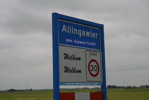
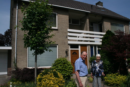
There was a house there, but it has most likely been rebuilt. I don't think it was more than 100 years old. We did knock on the door, but no one was home. It made it less awkward to take pictures of a stranger's house.
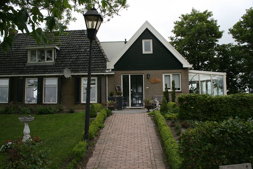
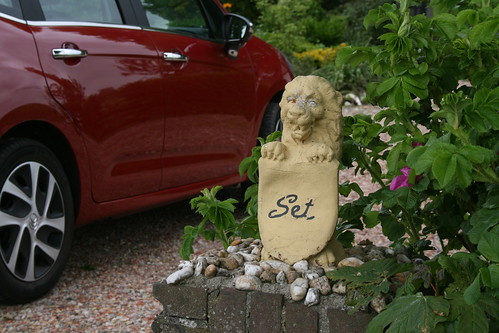
Then we noticed on one of the pillars in front driveway that is said Set! That is pretty much the same as Zet.
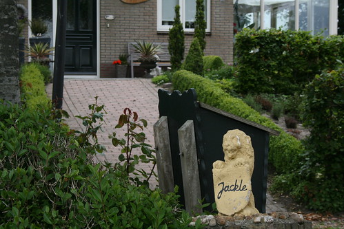
The other pillar said Jakle. So put them together and you get Jakle Set.
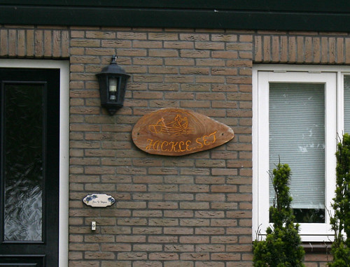
We noticed on the front of the house that there was a wooden sign that said Jakle Set with a couple guys in a boat.
After looking around we moved on and visited some other villages, then went back to where we were staying. When we got back we did a little more investigation. Here is a Google maps view of where Jakle Zet is.
View Larger Map
Now here is what comes up in the 1832 reference map. Do you notice a pretty major difference?
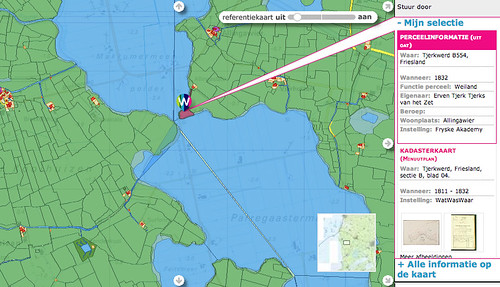
There used to be lakes there! And Jakle Zet was at a point between the 2 lakes where the land almost came together. I looked up the area on some older maps. Here is what it looked like in 1664:
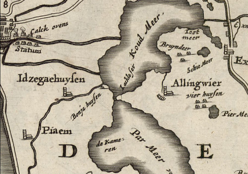
Here is what it was like in 1718.
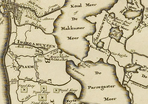
Now here is a map from 1854 and on this one it has Jakle Zet, but it also says overzet underneath.


So what does all this mean besides the fact that I like to look at maps? What is a Zet? Our cousin Jaap Heeringa, who we were staying with, let us know that it meant a bridge. A narrow bridge that would turn. So when people wanted to cross, it bridged the land, but when boats needed to get through it would turn on a pedestal and let them pass on either side. Here is a modern version of what it would kinda look like. I found this animated gif to the right on Wikipedia. So then what is an overzet? Well it turns out that at some point in history, that narrow waterway got wider, and the swing bridge either fell down or wouldn't work anymore or something. So they had to ferry people across in a boat. So probably that's why on the house there was an image of a boat.
So what is a Jakle Zet? Well it turns our that Jakle is the name of a man. Again with the aid of cousin Jaap, we discovered some history of the area in a book, and it talked about Jakle Zet. I also found the same text from the book online
here, in the chapter about Allingawier.
I only speak English, and the book is in Dutch. I took the text and ran it through Google translate and here is the
approximation of what the book says:
One would therefore, in view of all that water, assume that the residents have always led. A quiet and peaceable life here Villages in the same position as Eernewoude and Suawoude, have not known the storms of the Middle Ages. But that is at least not always been the case with Allingawier. Between the two large lakes was a fairly narrow connection. Originally it is probably a normal speed, which a "turn" was. When this trade was later widened by erosion, there was a spring. The name Jacle Set is given to a house on the road to Allingawier near Workum and is maintained, inhabited by Mr. Elzinga.
Then in 1878 the two lakes were drained - of which more later - also disappeared spring. At the Jacle Set reminds adopted the surname Van 't Zet, by the occupant of the house Jacle Set, Tjerk Tjerks in 1811. The name is probably derived from Jacla Feddes, who around 1450 had a stins here. He was vetkoper and controlled by his fortified house the transition across the water between the lakes. A strategic position, so we would say. This also includes the Schieringers and therefore tried Douwe Sjaardema and Epe Aylva there also to build a strength in order "to cut off Jacla Feddes and Vetkopers pass and passing." Their attempt, which they undertook in 1449, however, was by Janco Douwema en. Jacla with other Vetkopers prevented under construction and the strength was "razed to the ground." This does not let the Schieringers outdone. Five years later appeared Goslijck Jongema and a troop Schieringers, supported by citizens of Bolsward, in Allingawier. They destroyed the stins of Jacla Feddes and beat him with 15 helpers death. The stins of Jacla with was razed and Jongema took possession of the goods of cases Jacla. There is probably nothing when rebuilt, because in ancient chronicles and old maps is not stins more.
So, to sum up, there is some interesting stuff there. At that point between the 2 lakes there used to be a "stins." A stins is a fortified tower. Only super rich people could have had one, big land owners. This tower was owned by Jacle Feddes around 1450, but was destroyed 5 years later and Jacle was killed. There are only a couple of stins left in Friesland, and we got to visit one. This is similar to what Jacle would have had.

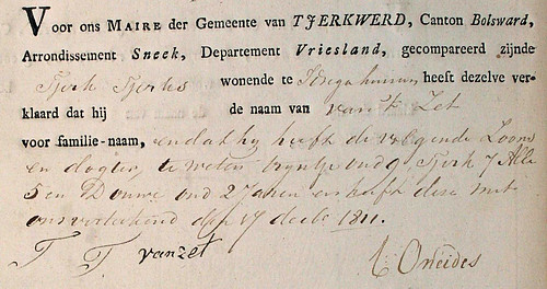
So that place, with the turning bridge, was named after Jakle, and they called it "Jakle Zet." My 5 great grandfather, Tjerk Tjerks, lived there. In 1811 all inhabitants of the Netherlands had to register a family name - a last name. Since Tjerk was living at the set/bridge, he took the family name "van het Zet" - "from the set."
So that's what his name means. Tjerk Tjerks van 't Zet registered his family name on 17 December 1811, 202 years ago today. Here is that document that shows his official name.
